|
|
|
|
|
|
|
|
|
|
|
|
roundabout art of les landes
|
|
||
|
|
|||
|
new! Cathedrale Saint-Gatien at Tours
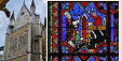
the perpendicular or English style of cathedral the fire at the cathedral of Notre-Dame de Paris Stone tracery in church and
cathedral construction stained glass and cathedrals in Normandy fortified churches, mostly in Les Landes cathedral labyrinths and mazes in France Germans in France on first arriving in France - driving
Transbordeur bridges in France and the world 2: focus on Portugalete, Chicago,
Rochefort-Martrou France’s western isles: Ile de Ré Ile de France, Paris: in the context of Abelard and of French cathedrals Marianne - a French national symbol, with French definitive stamps la Belle Epoque
Pic du Midi - observing stars clearly, A64 Futuroscope the French umbrella & Aurillac 50 years old:
Citroën DS the forest as seen by Francois Mauriac, and today bastide towns what a hair cut! m & french pop/rock
|
||
the department and forest of landesThe lowly-populated and highly forested French Department of “Les Landes” is a very strange, almost extra-terrestrial, magical man-made landscape. Here are a few factlets:
From Roman times and before, the now forested Gascogne area was covered by desolate and sandy moors and marshes, occasionally dotted with small stands of trees. The dunes gradually encroached inland. As they rolled inwards - up to 40m a year - the dunes created marshes and miasmas as they merged with and submerged streams and rivers. Thus Landes was an area of great poverty. Despite the vast forests now visible, the soil beneath remains very sandy and soft. The Aquitaine coast has one 220km long uninterupted sandy beach from the estuary of the Adour river to that of the Gironde. 105km of this coastline is in the Department of Les Landes, making it the Department with the longest coastline. The coastline is dotted with holiday towns, supervised beaches and some of the best surfing beaches in Europe along with factories for the major surfing companies. Les Landes had to wait until the 18th and 19th century to be rescued from its sandy and marshy fate. From 1784, a bridge and causeway engineer called Brémontier experimented successfully on 250 hectares between Arcachon and the Pyla dune (the biggest dune in Europe). In 1801, he received a commission to stabilise 100,000 hectares of coastal dunes by planting resinous trees. His major works, which continued until the 1860s, were the first stage in creating today's great forest.
“There is perhaps no other area in Europe where the waters are worse than in Landes. In winter, they submerge everything; there is the appearance of a universal flood. In the other seasons, it is truely the scene of the the most complete drought. The waters disappear, but they remain almost at the level of the soil, and the ground is no less lastingly watered.” (St. Aman, 1818) In 1842, Chambrelent, who was responsible for the navigation routes of Gironde, moved onto the decontamination of the interior. There were at least 800,000 hectares in need of drainage. In order to persuade the public powers to release the necessary funds, he bought 500 hectare of wet moors, which he cleaned up by digging trenches, collection pools and pine plantations. Various other property owners also applied his techniques. In 1855, 20,000 hectares were cleaned up and sown. Napoleon III also applied Chambrelent’s measures, causing the aquisition of 7,400 hectares named after his Solférino battle against the Austrians. In 1857, a law was passed ordering the communes of marsh/moor areas to clean up and plant their own areas. The agricultural roads and drainage ditches were to constructed and connected on a departmental level. For the municipalities that could not pay for the works themselves, the state would lend them sufficient monies and were to repaid from the products that would come from the plantations. Eight years later, in 1865, all the clean-up work was completed, including a canal connecting the Hourtin and Lacanau lakes and extending to the nearby Arcachon basin. In the next 50 years, the forest quadrupled in size, growing to 1 million hectares. Thus ended the ancient moors, marshes and giant flooks of sheep. The industry of region was moved over to wood and resin products. Nevertheless the growing riches of the region did not filter down to the original peasantry until recent decades. roundabout art of les landes
Les Landes is home to many traditional industries and crafts. Driving around the department, one occasionally trips across roundabouts with spectacular depictions of some of these industries. There are roundabouts like this in other departments also, some of which we hope to report on later.
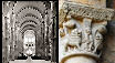
Chalosse is a centre of the French furniture industry. This amazing sculpture belongs to the nearby town of Hagetmau. This giant chair (5m x 5m x 10.62m / 16'5'' x 16'5'' x 34'10'') appears out of nowhere on a largely deserted country road on the western outskirts of Hagetmau. The other two roundabouts marked green on our map are also prettier than most, but not nearly as spectacular. The town of Hagetmau itself is worth a visit - the town is a comfortable place to walk around and has a number of small well-kept historical sites, including a 12th century chapel and crypt with carved columns.
man on stilts at mont-de-marsan
When Landes was barren moors and marshes, shepherds on stilts roamed the landscape herding giant herds of sheep. They wore stilts for various reasons: so they could walk over the plant-life more easily, so they didn't get wet or stuck in the mud, so that they could observe their flocks over greater distances, and of course because it looks cool. As the marshes were cleared and the forests grew, the shepherds disappeared. However, the stilts survived in village plays and dances. The first stilt dance group was founded by Sylvian Dornon in Arcachon. Dornon also organised and participated in various of the long distance stilt races, including the 1891 Paris to Moscow race: 2,850km (1,770 miles) in 58 days. There are now many troupes of stilt dancers in the Landes area who perform at festivals across the region. The ones I've seen are seriously impressive. It looks at least as much fun as rollerblading! This abstract sculpture is on a roundabout on one of the main roads into the capital of the Department of Les Landes, Mont-de-Marsan. It is not as high as the chair, but still impressive. If you are lucky, you see Mirages and other fast planes streaking overhead - there is an airbase nearby.
oil derrick at parentis-en-born
The two main locations for oil and gas drilling in France are the Paris Basin and the Parentis Basin. In 2000, the Aquitaine region produced 662,646 tonnes of crude oil, 2.71 million cubic metres of crude gas and 1.69 million cubic metres of refined gas. 160,000 tonnes of oil and 10,000 million cubic metres of gas came from the Parentis deposit, now owned by the Canadian company, Vermilion Energy Trust.
In 1954, Esso discovered the Parentis deposit. By 2003, the deposit was producing over 142,000 tonnes a year. Recently, Vermilion applied for a further 25-year extention to their drilling permit. This means that this oilfield will be exploited for more than 75 years. In 2005, the Paris Basin produced 54% of France’s crude oil, against 45% from Aquitaine. Amongst the Aquitaine fields, Parentis was far in the lead, producing 143,000 tonnes. (The rest of France’s crude oil production - approximately 1% - comes from numerous small fields, each producing under 20,000 tonnes annually. There are currently 63 oilfields being exploited in France.) Parentis-sur-Born has a small “petrol museum” in the town centre, a few blocks from the Tourist Information Office. Their guided presentation includes a walk around the local oil field.
resin pot at st-geours-de-maremne
end notes |
|
|
| abstracts | briefings | information | headlines | loud music & hearing damage | children & television violence | what is memory, and intelligence? | about abelard |
|
© abelard, 2005, 04 october the address for this document is https://www.abelard.org/france/les_landes_roundabout_art.php 1535 words |